Gauss centre: the temporal change of geospatial data
| Team: | M. Dorozynski, M. Ortega, F. Rottensteiner, M. Teimouri, A. Langer |
| Jahr: | 2022 |
| Förderung: | Federal Agency for Cartography and Geodesy (BKG) |
| Laufzeit: | Since 2022 |
| Weitere Informationen | https://www.gausszentrum.uni-hannover.de |
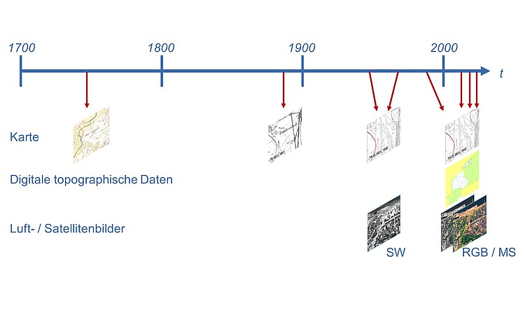
The goal of the project is to develop methods for the automated classification, storage, and analysis of geodata from different times and of different qualities. In this context, the analysis of time series is of interest because changes in the landscape can thus be investigated, for example, in the context of different environmental protection purposes. Geodata of different origins and ages usually have very heterogeneous structures, so an analysis in the form of time series using conventional methods is not possible. Thus, prerequisites are created in the project to allow for a universal time series analysis of historical spatial data by storing them as semantically structured objects in a database.
In this context, the following research questions are to be answered:
- How can historical maps – including historical aerial images – be stored together with current maps, and how can changes over time be analyzed?
- Which (geo)information can be reliably derived from historical maps or historical aerial images?
- Can this be done in a predominantly automated process (AI support, especially Deep Learning), and are developed methods transferable to other maps?
- Which database structure is suitable to consider the various sources and harmonize them?
The studies focus on the possibilities of harmonising historical and modern data analysis.


