The Global Status of Topographic Mapping - A UNGGIM-ISPRS Project
| Team: | G. Konecny, U. Breitkopf, A. Radtke |
| Jahr: | 2012 |
| Laufzeit: | since 2012 |
Project description
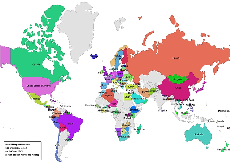
In December 2011, UNGGIM initiated a cooperative project with ISPRS to resume the former UN Secretariat studies on the status of topographic mapping in the world, conducted between 1968 and 1986. After the design of a questionnaire with 27 questions, the UNGGIM Secretariat sent the questionnaires to the UN member states. 115 replies were received from the 193 member states and regions thereof. Regarding the global data coverage and age, the UN questionnaire survey was supplemented by data from the Eastview database. For each of the 27 questions, an interactive viewer was programmed permitting the analysis of the results. The authoritative data coverage at the various scale ranges has greatly increased between 1986 and 2012. Now, a 30 % 1:25,000 map data coverage and a 75 % 1:50,000 map data coverage has been completed. Nevertheless, there is still an updating problem, as data for some countries is 10 to 30 years old. Private Industry, with Google, Microsoft and Navigation system providers, have undertaken huge efforts to supplement authoritative mapping. For critical areas on the globe, MGCP committed to military mapping at 1:50,000. ISPRS has decided to make such surveys a sustainable issue by establishing a working group.
Six years after the survey on the global status of topographic mapping a follow-up to the questionnaire sent in 2012 has been designed. Since April 2018 the UNGGIM has distributed the survey among the member countries who are kindly asked to participate. First results of the ongoing 2018 study are expected to be released in 2019.
Further material
- Questionnaire (2012)
- 'ISPRS Study on the Status of Mapping on the World' (background document) and (presentation) about the project (presented at 'Second High Level Forum on Global Geospatial Information Management', Quatar, Feb. 2013)
- UNGGIM-ISPRS Project: ‘Status of Mapping in the World’ (GIM article, Dec. 2013)
- Interactive webmap to view the results of the 2012-2015 study
- Questionnaire (2018)


