MI-SFS - Derivation of digital terrain models by means of multi-image shape (2006)

| Team: | Dipl.-Ing. Volker Lohse |
| Year: | 2006 |
| Funding: | Deutsche Forschungsgemeinschaft |
| Duration: | 2003- 2006 |
| Is Finished: | yes |
Research Group: Geometric aspects of sensors and images
Contact Person: Christian Heipke, Volker Lohse
Background
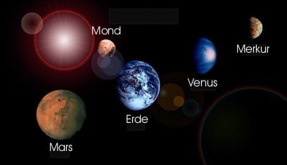
The study of the terrestrial planets represents a special challenge for the planetary- and geosciences, since these planets belong to our extended environment in the solar system. In the strict sense they are Mercury, Venus and Mars. In a broader sense also the moon and the large moons of the giant planets (Io, Europa, Ganymede, Callisto, Titan and Triton) belong to the terrestrial planets.

The scientific attraction of the research of the terrestrial planets lies above all in the understanding of the creation and development of our homeland planet.
The planet Mars is in many respects the most similar of the terrestrial planets to Earth and is simplest to reach after the moon. Therefore in the next years a huge number of missions will examine Mars (e.g. Mars Express, start 2003). For this reason Mars takes a special role in the DFG priority programme.
A goal of the priority programme is to understand the spatial and temporal connections of the planet creation, the development of planetary bodies, its surfaces and atmospheres as well as possible biological processes outside the Earth.
Fundamental elements of these investigations are the stratigraphical classification of the surface and the derivation of geological development processes. Using digital terrain models (DTM) a regional interpretation for these purposes can be achieved.
Goals and Methods
The goal of this research project is to develop a method for the derivation of high resolution DTM of planetary surfaces from digital images by combining digital image matching and Shape-from-Shading. The main focus is on images obtained from the upcoming Mars missions (e.g. Mars Express), but we also want to apply the method to images of other terrestrial planets. The DTM serves various purposes in the planetary sciences within and beyond the DFG priority programme, among which planetary mapping in the form of orthoimage mosaics and the selection of landing sites for future missions are perhaps the most important ones.
A substantial precondition for digital image matching is the presence of sufficient local texture in the image data. There are however areas, in which the surface does not possess the necessary texture. For these areas digital image matching fails. In particular this statement applies to images of planetary surfaces, which do not contain vegetation and man-made objects. For images of these areas other methods were developed for the reconstruction of the three-dimensional surface, one is Multi-Image Shape-from-Shading (MI-SFS). MI-SFS associates the brightness of a pixel in the image with the inclination of the appropriate element of the surface relative to the light source: The larger the angle between the surface-normal and the light source, the darker is the resulting grey value.
The suggested methodology is an integration of object based image matching and MI-SFS. The rationale for this approach is that both methods applied in isolation will fail to achieve the desired results given planetary images. The respective requirements for image texture are complementary. The work relates to an existing mathematical model for MI-SFS, to which some investigations have already been carried out. The goal of the work is an improved method for the automatic derivative of highly accurate DTM of planetary surfaces, as needed for many applications of the planetology.


