- Recognition and 3D reconstruction of topographic objects
- Multi-temporal, multi-scale and multi-sensor interpretation
- Quality control and update of geospatial data
CONTACT PERSON
CURRENT PROJECTS OF THE RESEARCH GROUP
-
SILKNOWTeam:Year: 2018Funding: EU (Horizon 2020 Programm)Duration: 2018 - 2021
![]()
![]()
-
Deep Domain Adaptation for the Classification of Aerial ImagesTeam:Year: 2018Duration: Since 2018
![]()
![]()
-
Multitemporal land cover classification of remote sensing data for national surveying tasksTeam:Year: 2019Funding: Landesamt für Geoinformation und Landesvermessung Niedersachsen (LGLN)Duration: 2019 - 2025
![]()
![]()
-
ForstCARe - Forestry Copernicus-based assistance service - Reducing the demand of reference data and fusing sensor data to fill data gaps due to cloud coverage for classification using artificial intelligence (AI)Team:Year: 2021Funding: Bundesamt für Wirtschaft und Energie
![]()
![]()
-
ReCyCONtrol - Self-learning control methods for an automatic production of robust and eco-friendly concretesTeam:Year: 2021Funding: Federal Ministry of Education and ResearchDuration: Since 01.06.2021
![]()
![]()
-
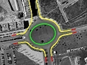
Gauss centre: the temporal change of geospatial dataTeam:Year: 2022Funding: Federal Agency for Cartography and Geodesy (BKG)Duration: seit 1.11.2022
![temporal change of geospatial data]()
![temporal change of geospatial data]()


